Megan Babel: North Dakota’s Falkirk Mine Leads the Nation in Drone-Based Mine Surveying Techniques
It takes imagination to look at a new, mostly recreational-based technology and make a connection to its use in the coal mining industry, but the Technical Group at North American Coal’s Falkirk Mining Company did just that. Their vision helped the Falkirk Mine become the nation’s first surface coal mine to operate a survey drone with approval from federal authorities. Greg Obrigewitch, a professional land surveyor, is part of this group.
Located about 50 miles north of Bismarck, N.D., the Falkirk Mine began using the Trimble UX5 drone in October of 2015 as a way to survey the land both before and after mining takes place.
Pre-mining surveys are required in order to plan for water management, to determine elevation and where exactly topsoil and subsoil should be removed and placed. Surveying is done after mining for reclamation purposes.
Uneven terrain creates time-consuming and often hazardous conditions for surveyors who traditionally inspect the land by truck or by foot. Drones provide an innovative way to retrieve topographical maps of large areas “with minimal wear and tear on equipment and workers,” Obrigewitch said.
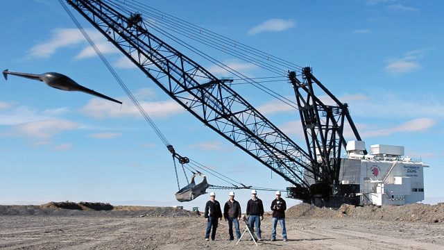
In order to get an exact 3-D image, which allows for measuring true distances due to the accurate, topographical representation of Earth’s surface, the fixed-wing Trimble UX5 is equipped with an on-board GPS system. For improved safety during takeoff, the UX5 uses a bungee cord system for launching, which starts the electric propeller only after the drone reaches 35 miles per hour.
The drone then flies up to 50 mph, by a pre-determined flight pattern, over a minimum of five 16-by-16 inch tiles that are used as a GPS reference. A photograph is taken about every 80 feet which allows the aerial software to create two inch pixel images from a height of 250-400 feet. The images are then merged by matching the edges to create the 3-D elevation map.
Time is saved in the field because the drone surveys around 400 acres per 50-minute flight. The data is downloaded to a computer and can be interpreted in a few hours or overnight.
Although one of the downsides of using a drone for land surveying is that it is not accurate over vegetation or water, according to Obrigewitch, it can be a “perfect tool for the North Dakota mining industry,” because much of the area is without vegetation during the mining process.
North American Coal Corporation’s Falkirk Mine sells its lignite coal to Great River Energy’s Coal Creek Station and Spiritwood Station. Electricity from the two stations helps provide power to roughly two-thirds of rural Minnesota.
What’s the next step in using this technology? Changes in federal regulations will allow the drone to be operated without a visual observer, making it a one-person job instead of two, which will again increase efficiency. Obrigewitch also said the mine is looking into purchasing a rotary drone, which has the ability to hover and maneuver in tighter spots, in order to inspect dragline and other machinery.